
Australia’s biggest council has 26 wards, and those wards are usually redrawn once every eight years. That time is here once again. The Local Government Change Commission yesterday kicked off the public consultation process for redrawing the wards of Brisbane City Council.
The rules for the redistribution resemble a state or federal redistribution: submissions can be made up until December 7. The LGCC will release a proposed ward map in early 2027 for further consultation.
Each ward needs to be within 10% of the average enrolment as of August 2026. In addition, the enrolment data includes projected enrolment data as of 2032, in the hope of ensuring that the wards can last for two rounds of council elections.
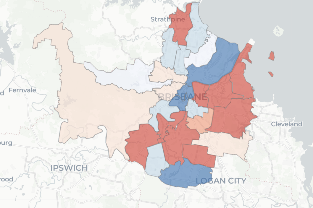
This map shows how much each ward deviates from the average.
The pattern is fairly clear. A large number of wards are 5-10% under quota, and all but one of them are on the south side of the Brisbane River.
The twelve wards north of the river collectively contain a surplus population of 29.3% of a seat, and this figure is projected to grow to 35.4% by March 2032.
Right now there are no wards which cross the river, but there would be a strong argument for the twelve northern wards to contract, and for one of the fourteen southern wards to spill across the river. This would then lead to many of the southern wards growing in population to equalise the trends.
I won’t try and make specific predictions about where the new lines will be drawn.
If you want to make your own map and make a submission, Jaxen at AURedistribution has loaded up the enrolment data and his app is a very easy way to draw compliant electoral boundaries.