NAT 17.09% vs LAB
Incumbent MP
Jo Goodhew, since 2008. Previously Member for Aoraki 2005-2008.
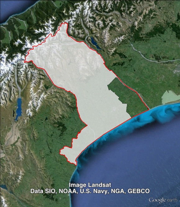
Geography
South Island. Rangitata covers rural areas to the south and west of Christchurch. The seat covers most of Ashburton council area and a small part of Timaru council area. Rangitata’s main towns are Timaru, Ashburton and Temuka.
Redistribution
No changes were made to Rangitata’s western or southern boundaries. The electorate lost a small part of Ashburton council area, including Rakaia, in the northeastern corner of the seat to Selwyn. Rangitata’s previous boundaries included the entirety of Ashburton council area. These changes cut the National margin from 21% to 17%.
History
The electorate of Rangitata in its current form has only existed since the last redistribution before the 2008 election. The seat largely replaced Aoraki, which had existed since 1996. Aoraki/Rangitata was won by Labour in 1996, 1999 and 2002, and by National since 2005.
Jim Sutton won Aoraki for Labour in 1996. Sutton had held Waitaki from 1984 to 1990, and Timaru from 1993 to 1996. Sutton served as a minister in the Labour government in 1990, and returned to the ministry in 1999.
Sutton was re-elected in Aoraki in 1999 and 2002.
In 2005, Sutton was defeated in Aoraki by National’s Jo Goodhew. Sutton won a party list seat, but retired in 2006.
Goodhew was re-elected in the new seat of Rangitata in 2008, and again in 2011. She has served as Minister of Community and Voluntary Sector since the 2011 election.
Candidates
- Tom Corbett (ACT #24)
- Steven Gibson (Labour #56)
- Jo Goodhew (National #21), Member for Rangitata.
- Oliver Vitali (Conservative)
Assessment
Rangitata is held by a solid 17% margin, which should be enough, but could be vulnerable in a situation where Labour is on track to form government.
2011 election results
| Electorate Votes | Party Votes | ||||||||
| Candidate | Party | Votes | % | Swing | Redist | Votes | % | Swing | Redist |
| Jo Goodhew | National | 19,580 | 55.77 | +5.18 | 54.99 | 19,282 | 53.66 | +5.09 | 53.19 |
| Julian Blanchard | Labour | 13,043 | 37.15 | +5.71 | 37.90 | 9,687 | 26.96 | -7.89 | 27.41 |
| Gerrie Ligtenberg | Green | 1,766 | 5.03 | +5.69 | 5.02 | 2,894 | 8.05 | +3.85 | 8.10 |
| Andrew McMillan | United Future | 418 | 1.19 | +0.73 | 1.21 | 307 | 0.85 | -0.01 | 0.87 |
| Tom Corbett | ACT | 303 | 0.86 | -0.77 | 0.87 | 367 | 1.02 | -2.75 | 1.01 |
| New Zealand First | 2,084 | 5.80 | +2.03 | 5.76 | |||||
| Conservative | 863 | 2.40 | +2.40 | 2.40 | |||||
| Legalise Cannabis | 229 | 0.64 | +0.10 | 0.63 | |||||
| Māori | 123 | 0.34 | +0.03 | 0.35 | |||||
| Mana | 32 | 0.09 | +0.09 | 0.09 | |||||
| Alliance | 24 | 0.07 | -0.04 | 0.07 | |||||
| Libertarianz | 20 | 0.06 | +0.03 | 0.06 | |||||
| Democrats | 19 | 0.05 | +0.02 | 0.06 | |||||
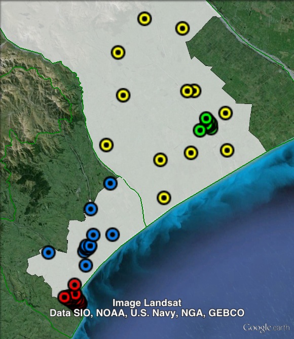
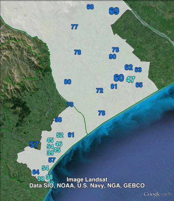
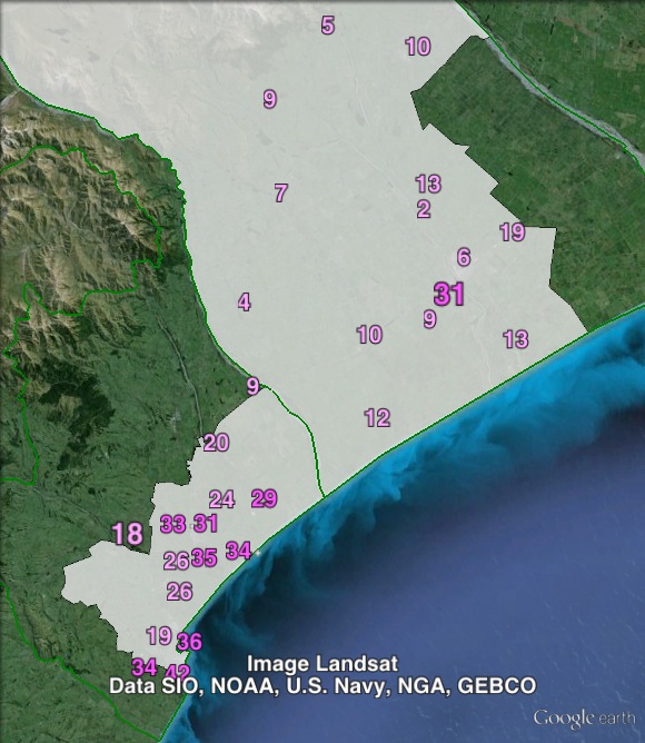
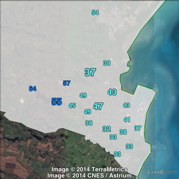
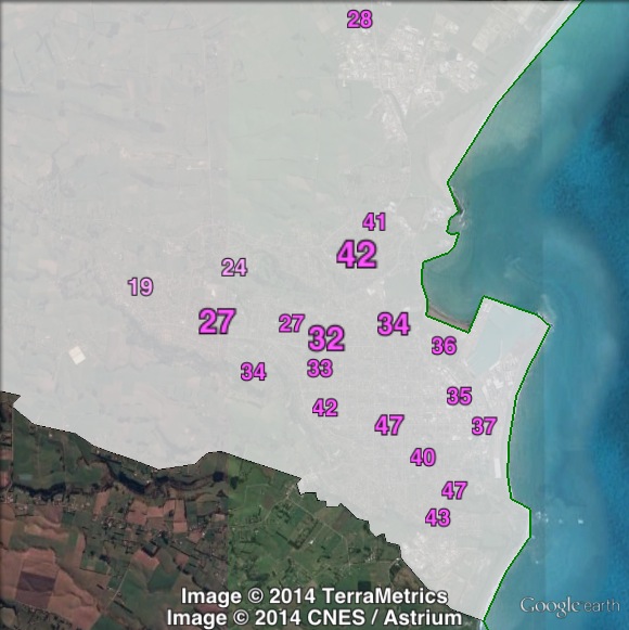
Booth breakdown
Booths in Rangitata have been divided into four areas. The main population centres in the electorate are Timaru and Ashburton. The remaining polling places have been split between north (in Ashburton council area) and south (in Timaru council area).
The National Party won the electorate vote in three out of four areas. Labour won a majority of the electorate vote in Timaru. National won large majorities in Ashburton (66.6%) and North (80.6%). National won a 49.6% plurality in the south.
On the party vote, National won a majority in Ashburton, North and South, and a 43.3% plurality in Timaru.
| Voter group | Electorate votes | Party votes | Total | % of votes | |||||
| NAT | LAB | GRN | NAT | LAB | GRN | NZF | |||
| Timaru | 40.14 | 52.07 | 5.54 | 43.28 | 35.76 | 9.37 | 6.27 | 12,033 | 35.81 |
| Ashburton | 66.61 | 27.76 | 3.98 | 58.64 | 23.19 | 5.96 | 6.54 | 8,015 | 23.85 |
| South | 49.61 | 41.99 | 6.02 | 50.08 | 27.62 | 9.12 | 6.77 | 4,118 | 12.26 |
| North | 80.57 | 12.69 | 4.21 | 73.15 | 9.56 | 7.00 | 3.91 | 2,995 | 8.91 |
| Other votes | 59.84 | 33.19 | 5.09 | 57.42 | 25.33 | 8.30 | 4.09 | 6,438 | 19.16 |
Ben, you’ve got a mistake in the percentages for the 2011 electorate votes. The National candidate presumably got 53% rather than 63%.
Thanks Nick, you’re right that it’s wrong. It turns out that the total vote that I used to calculate the percentages was swapped between Rangitata and Rangitīkei, so both were wrong.
My prediction: National hold.