Council margin – LNP 1.8%
Mayoral margin – LNP 10.6%
Incumbent councillor
Ryan Murphy, since 2012.
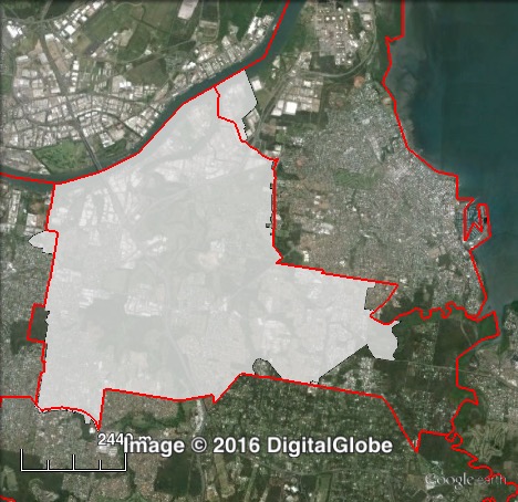
Geography
Eastern Brisbane. Doboy covers suburbs to the east of the Brisbane CBD, including Murarrie, Tingalpa and Carina.
Redistribution
Most changes to Doboy were relatively minor, swapping border territory with Morningside and Wynnum Manly. The main change was at the eastern edge of the ward, in the area around Ransome on the city boundary. This area was transferred into Chandler. These changes cut the LNP council margin from 4.6% to 1.8%, and the mayoral margin from 13.2% to 10.6%.
History
Labor’s John Campbell held Doboy for approximately thirty years from the early 1980s until 2012. Campbell served as opposition leader from 1990 to 1991 and as deputy mayor from 1991 to 1997.
Doboy had become quite marginal in the 2000s, with Campbell’s margin cut to 5% in 2004 and 1% in 2008.
In 2012, a 5.5% swing to the Liberal National Party saw Campbell lose to LNP candidate Ryan Murphy.
Candidates
- Kerryn Loose James (Labor)
- Ryan Murphy (Liberal National)
- Dave Nelson (Greens)
- Luke Quinn (Independent)
Assessment
Doboy is the LNP’s most marginal seat, and if there is any shift back to Labor they would be hoping to win Doboy.
2012 council result
| Candidate | Party | Votes | % | Swing | Redist |
| Ryan Murphy | Liberal National | 11,946 | 54.6 | +8.7 | 51.8 |
| John Campbell | Labor | 9,953 | 45.5 | -1.5 | 48.2 |
| Informal | 581 | 2.6 |
2012 mayoral result
| Candidate | Party | Votes | % | Swing | Redist |
| Graham Quirk | Liberal National | 12,785 | 58.3 | +1.3 | 55.5 |
| Ray Smith | Labor | 7,112 | 32.4 | -2.3 | 34.6 |
| Andrew Bartlett | Greens | 1,536 | 7.0 | +1.4 | 7.4 |
| Rory Killen | Independent | 315 | 1.4 | +1.4 | 1.5 |
| Chris Carson | Independent | 202 | 0.9 | +0.9 | 1.0 |
| Informal | 519 | 2.3 |
2012 mayoral two-party-preferred result
| Candidate | Party | Votes | % | Swing | Redist |
| Graham Quirk | Liberal National | 13,007 | 63.2 | +1.8 | 60.6 |
| Ray Smith | Labor | 7,567 | 36.8 | -1.8 | 39.4 |
| Exhausted | 1,376 |
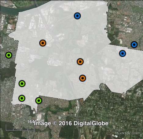
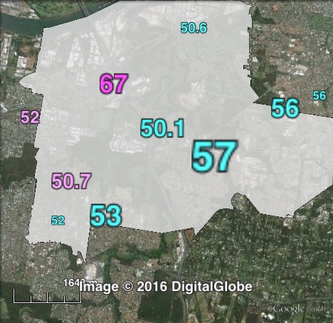
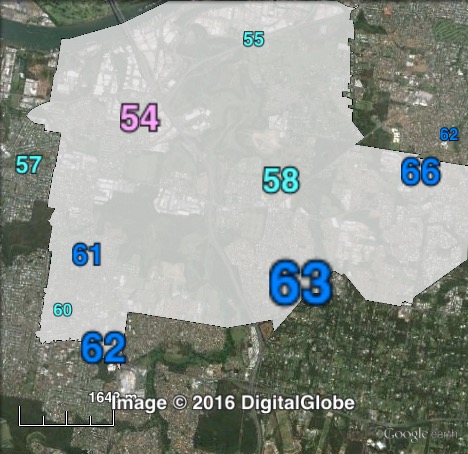
Booth breakdown
Booths in Doboy have been split into three parts: central, east and west. Tingalpa and Murarrie are in the centre, Bayside, Hemmant and Wondall Heights are in the east and Carina and Cannon Hill are in the west.
The LNP vote is highest at the eastern edge of the ward, and lowest in the centre. The ALP managed a slim 51.5% majority of the council vote in the three booths in the centre of the ward. A similar pattern is seen in the mayoral vote, with the LNP polling 8-10% higher in each area than in the council vote.
| Voter group | LNP council 2PP | LNP mayoral 2PP | Total votes | % of votes |
| Central | 48.5 | 56.9 | 5,239 | 30.8 |
| West | 50.8 | 60.2 | 4,626 | 27.2 |
| East | 54.7 | 62.4 | 2,718 | 16.0 |
| Other votes | 55.1 | 64.1 | 4,409 | 25.9 |